Visualizing the Pyrocene: The Fort McMurray Project
2023
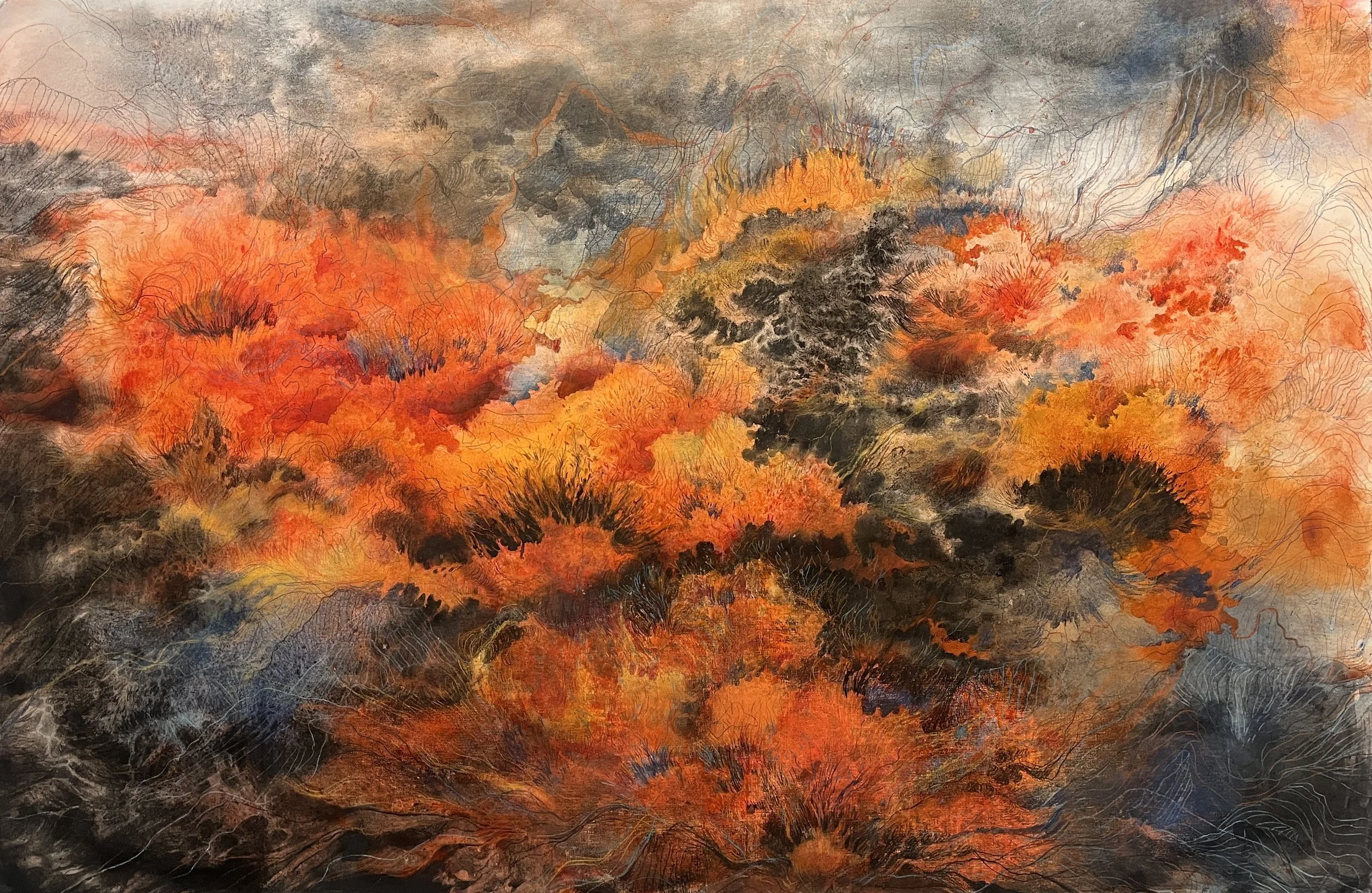
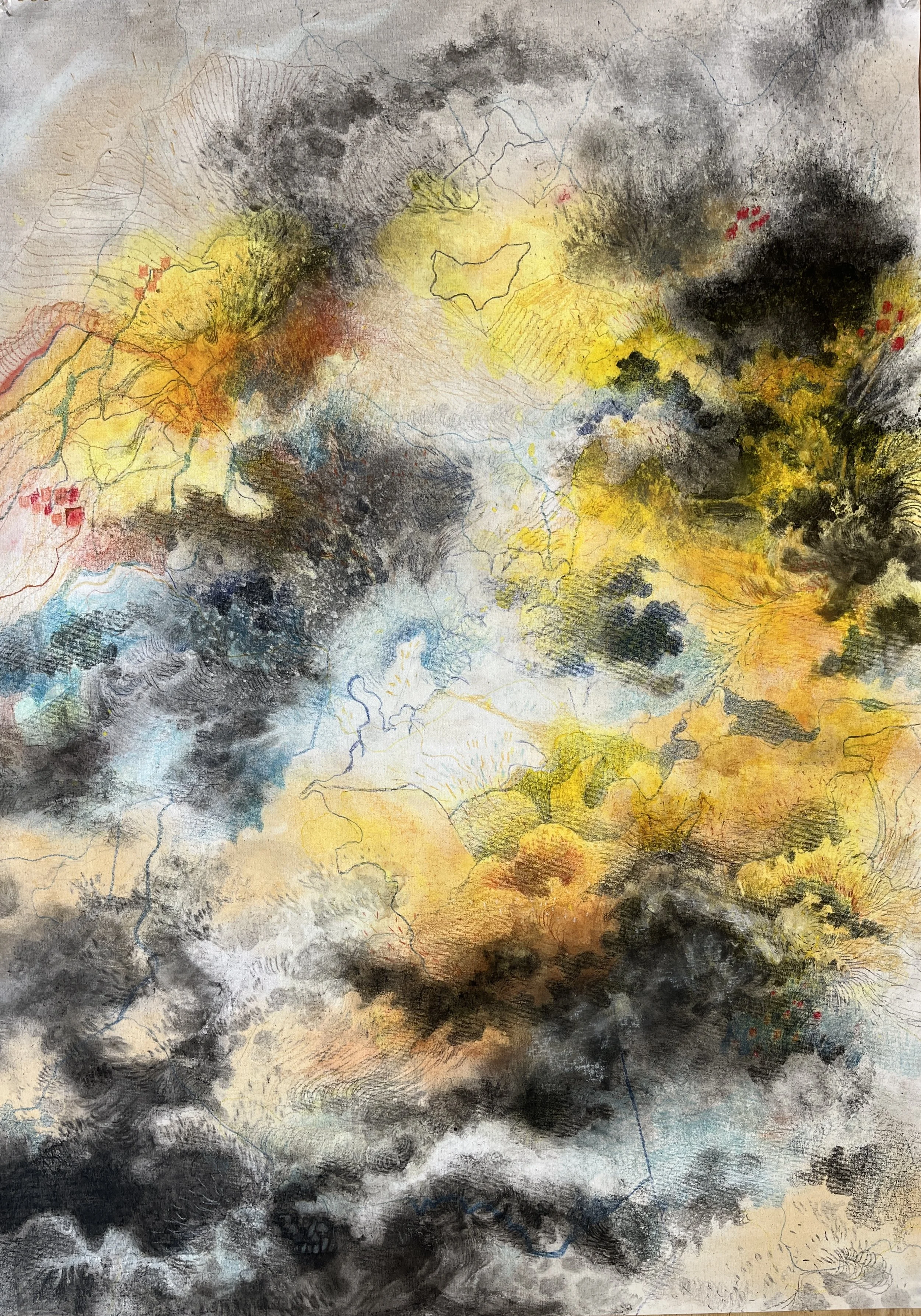
The Pyrocene, suggested by Pyne, is a new geological epoch that has emerged in the aftermath of the Anthropocene, marked by the uncontrollable force and dominance of human activities over nature, causing irreparable damage. The Pyrocene proposes a fire-centric perspective on the Anthropocene, focusing solely on the relationship between humans and fire. Nowadays, the increase in the amount of fire in the Earth’s ecosystem and its consequences, such as deforestation resulting from wildfires due to climate change in the Pyrocene, presents an urgent environmental crisis both locally in the Canadian context and globally.
My research creation delves into the phenomenon of wildfires, particularly focusing on the devastating Fort McMurray wildfire of 2016, within the context of Alberta, Canada. This wildfire burned over 500 thousand hectares and caused significant loss and damage to the environment and the residing community. The project aims to channel my passion for exploring the human-nature relationship through environmental issues into a meaningful endeavor that will serve both my personal artistic goals and contribute to the broader understanding of this crucial issue. The central question to be addressed is: How does the creative visualization of the Pyrocene's subject matter influence the emotional and cognitive responses of the audience, and how do they interact with this urgent global issue?
My research creation adopts a multidisciplinary methodology by integrating art, geology, and environmental science. The project aligns with its interdisciplinary and creative essence. The collection and analysis of data are conducted through critical methodologies, employing a post-humanism approach and multi-species ethnography. This strategy aims to underscore the intricate connections and interdependencies between humans and other species, emphasizing a perspective that refrains from granting sole agency to humans in dominating the environment.
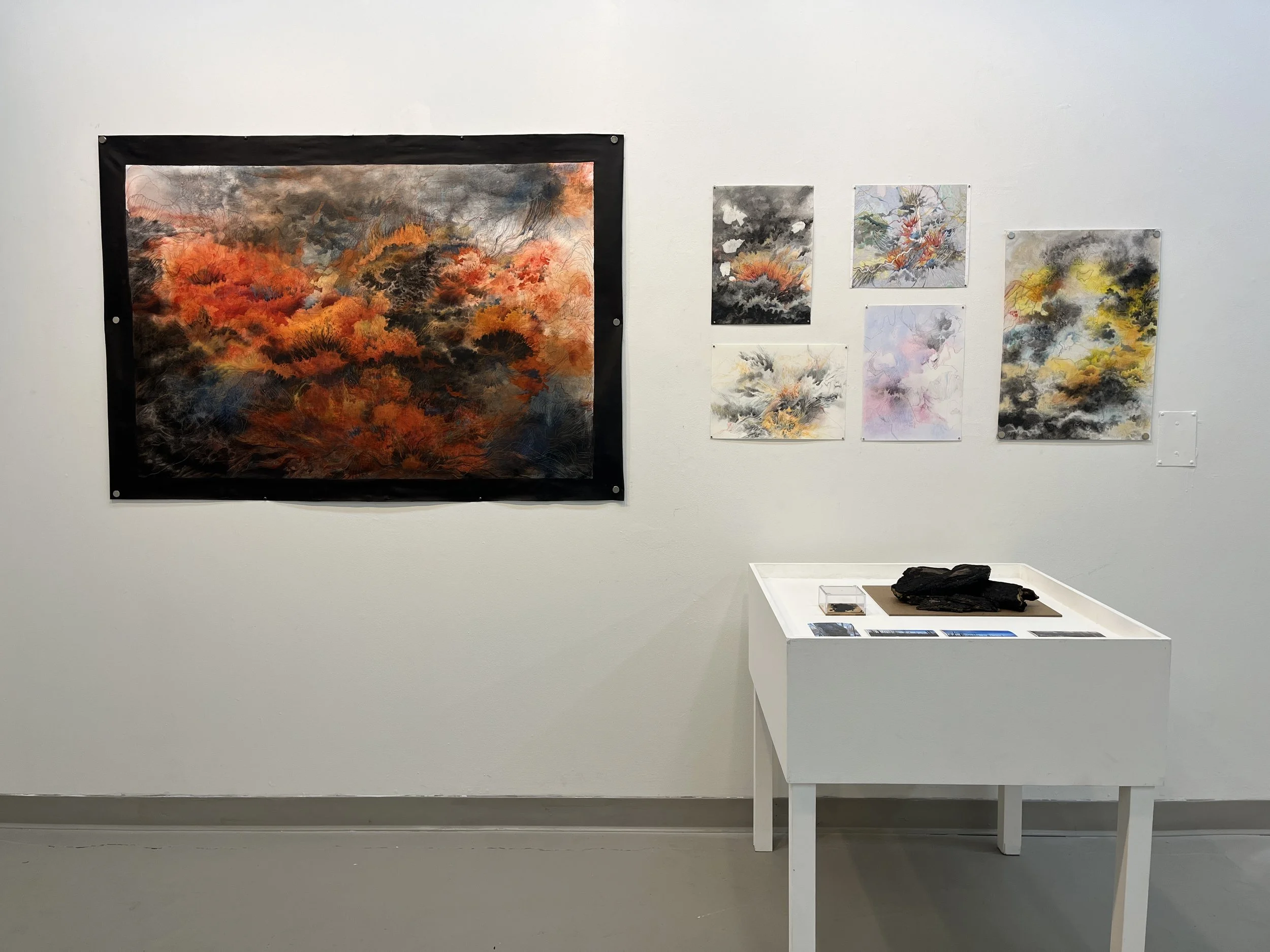
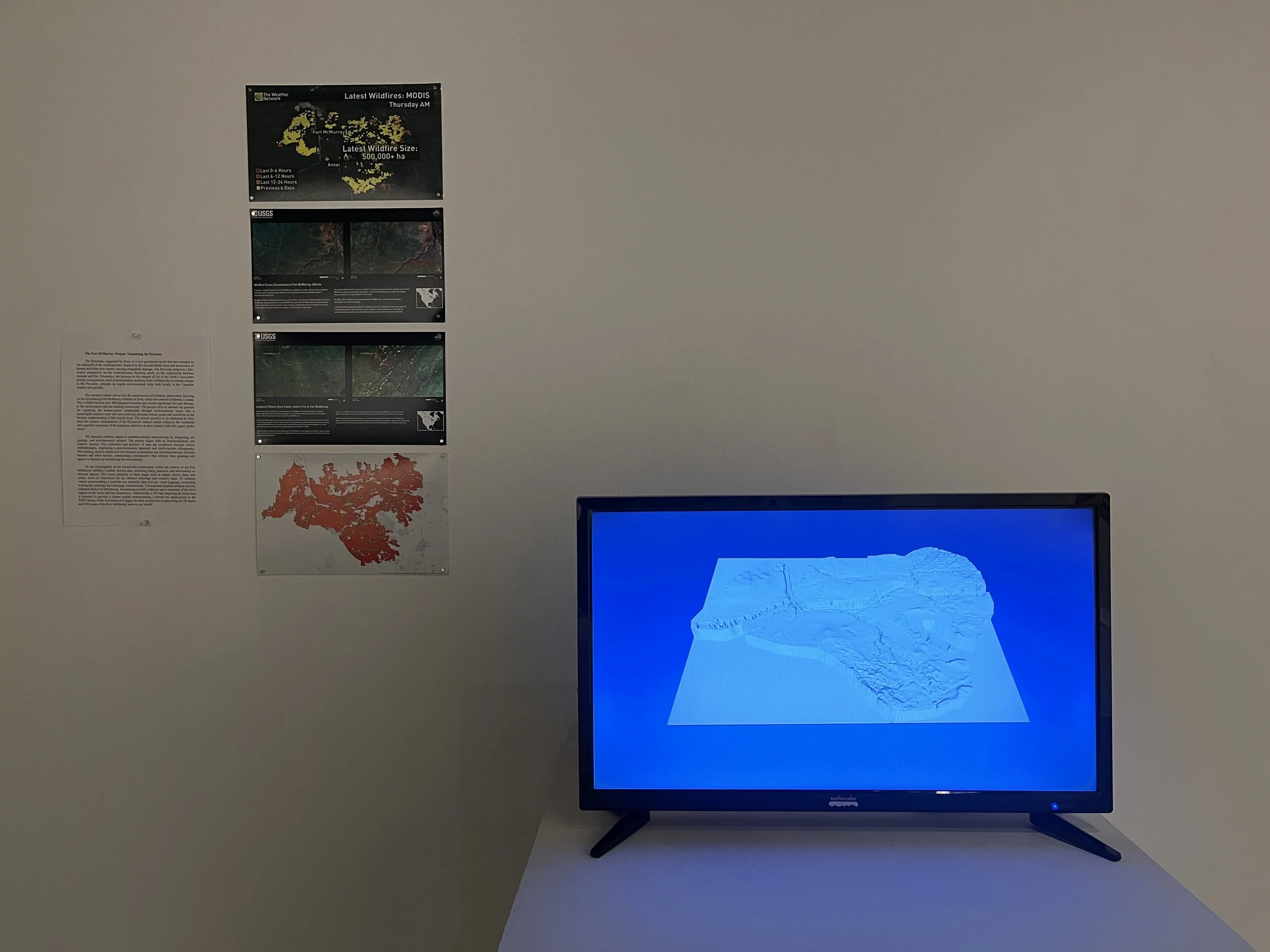
In my investigation of the human-fire relationship within the context of the Fort McMurray wildfire, I collect diverse data, including maps, statistics, and information on relevant species. The visual elements of these maps, such as shapes, forms, lines, and colors, serve as inspiration for my abstract drawings and creative maps. To enhance viewer understanding, I translate raw scientific data into my visual language, presenting it alongside paintings and drawings. Intentionally, I incorporate tangible artifacts directly collected from Fort McMurray, functioning as both evidence and a memorial of the fire's impact on the forest and the community. Additionally, a 3D map depicting the burnt area is included to provide a clearer spatial understanding. I extend my appreciation to the TDFL library of the University of Calgary for their pivotal role in generating the 3D model and GIS maps of the Fort McMurray area on my behalf.